

![]() I think you know that Google Maps is capable to show the whole world in your computer screen and it’s implemented indifferent views and styles such as, satellite images and terrain view .In short it endeavor to makes your life more flexible, easier and faster for communications.In terms of functionality like you can get directions by using Google maps and also Global Positing System(GPS) which brings more accuracy and show your the real time of local positions. But, you’re looking something more? Such as, where to find restaurants, location of nearest ports, transport information, travel engine?
I think you know that Google Maps is capable to show the whole world in your computer screen and it’s implemented indifferent views and styles such as, satellite images and terrain view .In short it endeavor to makes your life more flexible, easier and faster for communications.In terms of functionality like you can get directions by using Google maps and also Global Positing System(GPS) which brings more accuracy and show your the real time of local positions. But, you’re looking something more? Such as, where to find restaurants, location of nearest ports, transport information, travel engine?
Thiere are lots of free web tools that brings great things in Google Maps which is not usually available by using simple Google Maps API.These all tools are the veneration and work done on the api codes,you can also make something great which can showoff your name ( help others) within broader networks. In before we have seen the real time location of twitter user and now it’s crossing the boundaries and bits more and more things coming shortly. What things you’re looking lets search in below as here is the list of 50+ Great Google Maps Tools:
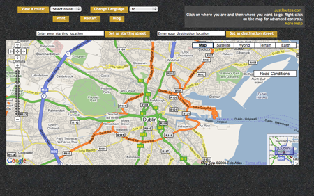
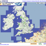
- Dublin Public Transport Advisor — Around the Dublin, wants to make trip plan, you can use this service to making plan about public transportation.
- Most Dangerous Roads on Earth — It’s showing the world’s most dangerous roads in the maps.
- Perfect Escapes — It’s using Google Maps search engine interface which will work when you need to search anything about travel or alternatively you can use as travel search engine.
- Hotspotr — More then 14,875 wifi hotspots are showing over the country in the maps.
- Safe2pee.org — Easy to find out public bathroom in any country.
- Wines and Times — In united states – by using this maps you can make plan for a winey tour.
- Fastfoodmaps.com — Inside United States easily you can find fast food restaurants, including all world famous companies such as McDonald’s, Pizza Hut, KFC, Wendy’s and so on.
- Photo Enforced — Get maps of red light cameras in multiple cities across the United States.
- World Port Source – By using their service you can find ports and more then 3,100 ports in 189 countries are available and easy to find the right locations.
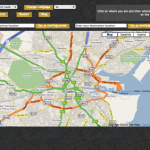
- FlexTraffic — In United Kingdom by using this maps you may check the traffic delays and construction areas or any specific projects information.
- Cheap Hotels — It’s covering more then 66000 low price hotel’s information and it’s covering more then 165 countries and and will give chance to book online.
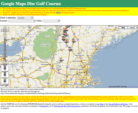
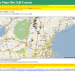
- Google Maps Disc Golf Courses — This maps covering disc golf/frisbee golf courses all over the United States and easy to find the locations, descriptions and full directions.
- Live Sports Map — By using this Google maps, you can find and see sports score and watch the news on popup and including stadium and arena satellite views.
- FindLakes — It’s searching lakes over the country and more then 40000 laks showing around the country
- SafeFoodFinder — Seattle area based restaurants and health department inspection scores which is enlisting by this maps and you can surf from anywhere.
- The World’s Most Polluted Cities — Geotagged based maps which showing polluted cities by photos — covering the whole world and specifically the whole Aisa.
- San Francisco Solar Map — Around the San Francisco this interactive maps showing residential, municipal, commercial, and other solar projects.
- RoofRay Solar Calculator — By using maps tools, you can find your house, trace your roof, determine the roof’s orientation and pitch and also a solar estimate.
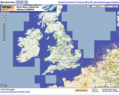
- Climate Change Wales 9- The rising of sea levels, flood levels and more changes of climates are tracking by this maps.
- United States Sea Level Rise Map 9- This maps which is showing geo-tagged photos that also reporting the impact of different sea level rises in cities around the United States.
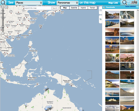
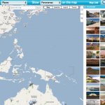
- Panedia – Over the whole world, you can see the placemarkers links and panoramic images.
- Driving Detroit — On this tools, you can link up photos, slideshows and other media and it’s easy to entertain in maps.
- Star Viewer — This maps showing sky in night mode and also Youtube video included and as well it’s showing different types of starts, galaxies and start’s systems in maps.A Google Map of the night sky that includes YouTube videos of different stars, galaxies, and star systems.
- GoogleDrive — If you like simulator based games, you can driving simulator games on Google maps.
- Real World Racer — Want to play car racing, you can use Google Maps and make a challege and enjoy it.
- 2D Driving Simulator — Flash driving based simulator games in Google Maps and it’s 2D driving simulator.
- Samknows — By using this service you can find house or building on maps and find out what types of broadband internet connection available in that area.
- Start to make Hole and end up the hole? — If you start to digging the whole world from any points where will i be up in another side? This maps trying to show your imaginations in reality.
- MapTube — Around 200 mashup maps are available in this directory.
- Popular Google Maps — Different topics are available and based on Google maps and you may browse by popular topics.
- Map Builder — Easily you can using Google Maps mashups builder and create your own maps.
- MapMyPage — Easy to puts Google maps on your websites — it’s simple to visible on your website.
- Map My Life — Easy to create life mapping and show your timeline and by using XML file you can provide those information.
- The Google Maps Image Cutter — A free application for cutting any image into tiles for use with the Google Maps interface.
- GMapCreator — This Google Maps creator helping to make thematic Google Maps easily.
- Geo Twitter — Geo-Code your tweeted things and plot them on an embed-able maps.
- Mapmsg.com — This applications help you to put a messages into the maps and email to anyone.
- Dual Maps — Do you have Microsoft Virtual Earth maps experiences? Free mapping tools will combine and will active Google maps view too.
- HeatMapAPI — You can overlay Google Maps by using this API and easily create your own heat maps.
- Where is the path (or street) — This masup applications will show the regular street and footpath in maps by using Google Maps satellite view and which is not indicating by GOogle Maps.
- 99Trails.com Philadelphia Map — A map showing walking and biking trails around the Philadelphia metro area.
- NYC Bike Maps — This maps showing New York Cities Bike Paths, lanes and green ways.
- I Need A Bike — If you’re in Paris, Lyon or Marseilles you can find the bike’s rental locations.
- Cassini — An overlay of 18th century maps over Google Maps that lets you adjust the transparency of either layer.
- Mapdango — A mash-ups that teaches about a new place every day, showing news, weather, and more.
- MapsZipcode — Nation wide this Google maps mash-ups showing zip codes of your area.
- London Profiler — If you’re looking for public demographic information about London, you can use London profiler and it’s great to find.
- Area Code Maps — This maps overlaying code maps and easy to get the area codes by using this maps.
- Flood Maps — Easily you can see new coastline which is on sea level and rises between 1 m to 14 m and this maps covering that flood relevant contents.
- MapEcos – By using this maps you can see the industrial facilites of U.S and also which toxic chemicals are using too.
Last but not least please feel free to share if you know any other tools.We will try to include your regards in the lists with your references.

Comments
447 responses to “50+ Great Google Maps Tools”